Building Singapore from the (Under)Ground Up
Building Singapore from the (Under)Ground Up

Meet the man who wants to get to the bottom of any issues in Singapore’s congested underground space.
Our 728sq km island has to squeeze in a staggering 5.8 million people — that puts a lot of pressure on our land constraints. As a small country with ever growing needs, Singapore’s demand for underground space will only continue to grow.
Planning, developing, and maintaining the underground space is vastly different from the world above, and is no easy feat. Unreliable information on rock structure, materials or minerals; previous underground installations like cables and tunnels, all these may lead to catastrophic consequences, inefficient or costly processes, if not considered carefully.
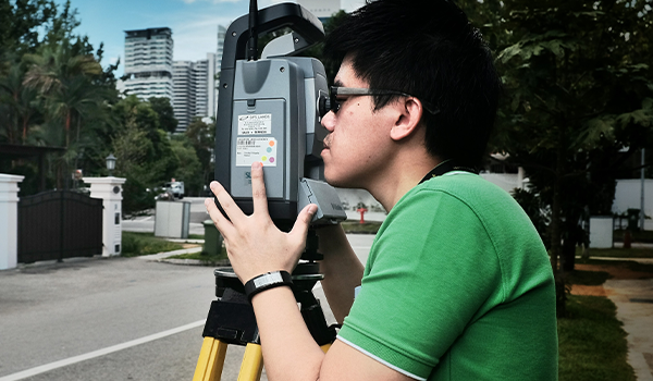
Richard Loo Wei Kiah joined SLA a decade ago and is currently a Senior Surveyor who manages the Digital Underground initiative where he researches and develops an ecosystem to capture reliable information of underground utilities in Singapore.
Welcome to Singapore: Below Ground
Richard works closely with research partner from the Singapore-ETH Centre and stakeholders from agencies and private sectors to put in place the necessary governance, workflow and submission framework , in support of Singapore’s underground space planning and administration.

Created in 2017, the Digital Underground’s remit sounds like the beginning of a sci-fi thriller. Its task: to create a reliable 3D underground utility map of Singapore by setting technical standards, creating a digital workflow, and gathering high-quality asset data.
Why the need for 3D maps? Regular maps are often represented in 2D, making it difficult for untrained persons to interpret. More importantly, 2D maps are limited when it comes to the amount of detail they can show.
By moving the underground utility map to one that is 3D and having them consolidated, all information can be stored and managed in one place. The extra dimension and increased granularity to map data will allow users to gather a more true-to-life visual.
His job takes him through a variety of tasks, including being out in the field to acquire information, doing data processing back in the office, and collaborating with stakeholders on continuous feedback for implementation .

The road mapping phase of the Digital Underground initiative, was the first time that the scanning on-road system was deployed in the Asia-Pacific region — and Richard played a role in that project. Piloting these systems serves as an important way to investigate different (better) methods of data capturing and to check the reliability of captured information about utilities underground.
He says that “every time we talk about this project, we are still proud that we successfully and safely deployed the gigantic machine in Singapore and operated it at an unprecedented scale, covering many kilometres of roads in challenging circumstances. I truly enjoyed the pragmatic collaboration and interactions between members of different teams from multiple stakeholders.” He adds, “I must say that without their support and commitment, we would not have been able to pull off this mammoth task.”
Senior Surveyor: a Gadget-lover’s Dream Job?
“I love that my job gives me the opportunity to interact and network with people as I get to learn something new every day at work,” Richard shares.
The geomatics profession is extremely dynamic. Richard has to constantly embrace changes and keep up with the rapid advancement of technologies. He believes that good spatial thinking is essential in this field and “if you are at least able to read maps, you won’t be lost if you are thrown into a forest”!
Through his research at work, Richard has been exposed to underground mapping tools and state-of-the-art gadgets that would make any gizmo geek drool. Despite this, he finds that introducing new technologies or workflows to the stakeholders is the hardest part of his job. People have to accept, learn, and appreciate them properly in order for them to be implemented effectively.
He is a strong believer in technology and trusts that everyone should embrace it. “Whether we like it or not, technology will continue to evolve and change the way we live, work and play. It is here to stay — but more importantly, it will continue to make our lives easier, faster, better, and more fun,” Richard says.
“For me, the fun in being a geomatics engineer is getting to play with sophisticated devices and exploring Singapore regularly. Trust me, you never know what you may encounter in the field. The scenic views and undiscovered areas make me forget about the heat and humidity outside. I encourage you to give working in this field a chance — I’m sure you won’t regret it!”

